March 2, 2025
Mountain height: 2464 m
Total elevation gain: 1000
m
Ascent time: 4:15
Descent time: 2:35
Scrambling and
a little mountaineering with Dave.
Day 2 of a
southern Alberta weekend and indecision reigned regarding a potential
objective. High avalanche risk would force us out to the front ranges where
there was little to no snow.  When I suggested the southeast side of Drywood
Mountain to Dave he was all in. I had inadvertently reached the summit via this
route trip in January of 2023 and found it be relatively safe and very
enjoyable.
When I suggested the southeast side of Drywood
Mountain to Dave he was all in. I had inadvertently reached the summit via this
route trip in January of 2023 and found it be relatively safe and very
enjoyable.
After walking
the 3 km approach (next time I’m biking this one, for sure!), we picked a line
and started up. We would deviate slightly from my previous route 3 times en
route to the summit; each of the variations providing outrageously cool rock
scenery and fun scrambling. In addition to Dave’s outstanding company, these detours
turned a terrific trip into an extraordinary one.
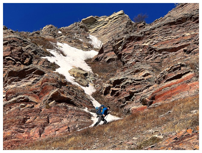
Deviation #1:
instead of ascending the nearby drainage and then scrambling steeply up to a
magnificent red argillite rock band, we hit the rock band from a point further
west and then scrambled up through a gully.  This yielded the coolest rock
scenery of the day. My camera was working overtime, and we had barely gained
any elevation!
This yielded the coolest rock
scenery of the day. My camera was working overtime, and we had barely gained
any elevation!
Above the rock
band we continued up, soon reaching the point where I had traversed into the
centre of the drainage to avoid the difficulties along the ridge. Although Dave
and I initially did the same, we quickly decided to gamble that some or all of
the ridge could be scrambled. It could not, but Deviation #2 was replete with
interesting route-finding, fun scrambling, and ridiculously vertiginous views
down the east side. On more than one occasion Dave forcefully commanded me to
take no further steps in an easterly direction!
Again, a
different route was used for the crux rock band (the infamous limestone one), Dave
leading the way. Both this one and the route I used before worked very well.
The final
slight change we made to the route was to follow a steep snow slope up to the
summit ridge.  I had used a less steep slope to the right in 2023. In full
mountaineering mode, Dave led the entire slope, punching out a beautiful
staircase of snow hollows for me to follow. Big thank you to the big guy here –
I was sucking wind throughout the entire ascent and extremely appreciative of all
Dave’s hard work on this section. Once on the ridge, the summit was a very
short scramble away.
I had used a less steep slope to the right in 2023. In full
mountaineering mode, Dave led the entire slope, punching out a beautiful
staircase of snow hollows for me to follow. Big thank you to the big guy here –
I was sucking wind throughout the entire ascent and extremely appreciative of all
Dave’s hard work on this section. Once on the ridge, the summit was a very
short scramble away.
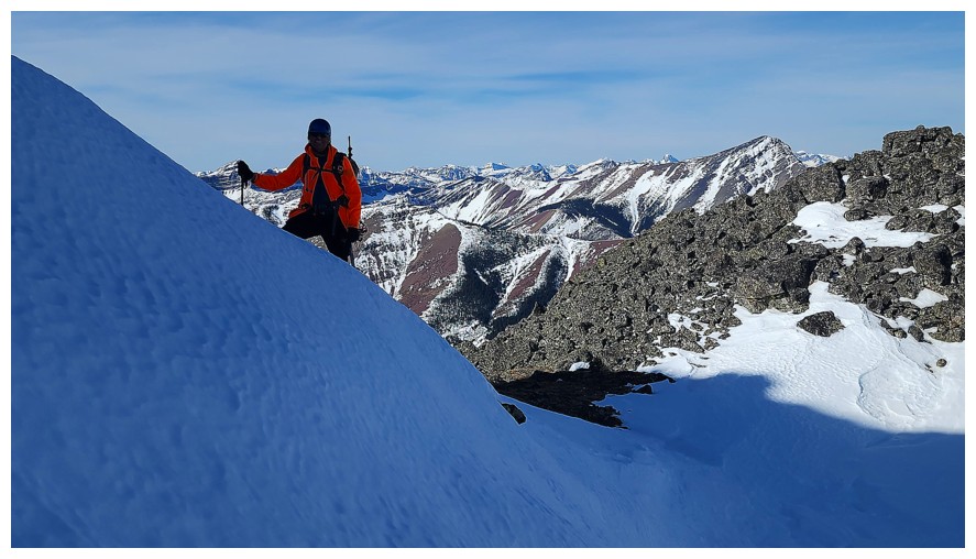
We didn’t
linger too long at the top. This was my seventh time at the summit and Dave’s
second – the wonderful summit view was a stranger to neither.
For descent, we
chose to follow our uptrack for the first half and then descend alongside
the drainage for the latter. This is the most expedient and logical route down,
boasting a few sections of good scree surfing and generally easy travel.
The 3 km hike
back to the trailhead went super fast, not because of our brisk pace, but for
the lively conversation reliving what turned out to be a tremendously rewarding
and fun day out.
I’ve no doubt
this route will see me (and hopefully Dave) again!
Click HERE to see Dave's excellent report.

Two of the four moose that sprinted past me on the drive in. Mount Roche (Spread Eagle Mountain) in the background.

Hiking the gas road. Woody and Drywood ahead (photo by Dave).

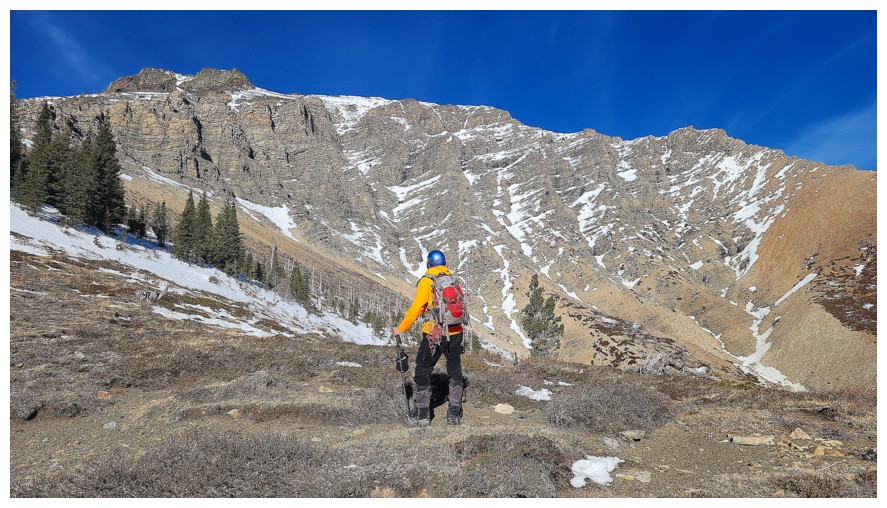
Checking out the upcoming route from afar (photo by Dave)

And now up-close

Close-up of Drywood's beautiful summit block

The ascent begins (photo by Dave)

Dave leads the way (as he did for most of the day) up to the red argillite rock band

Nostalgic look over to Ciabata and The Breadsticks (photo by Dave)

With some dead trees

Dave stands at the base of a seriously cool feature

Time for less layers and helmets. The rock by Dave is super red - how red?

...this red!

Dave checks out a potential route up the first gully, but the footing wasn't great
Of course, I'm now obsessed with that red rock!

And other amazing things above

We took slightly different routes to gain some elevation through the initial stages of the rock band (photo by Dave)

Spot the Scot!

Same as above

There were multiple options to get above the rock band and Dave (dwarfed here by the rock above) found the most scenic one

Up and then right

I follow his lead (photo by Dave)

Dave is "leaning into" the amazing rock scenery!

Easy and scenic route up to the top

Zoomed-in shot of what Dave sees at the top of the band. The summit looks close, but we have a ways to go (photo by Dave).

Can't limited yourself to admiring red argillite only. The dolostone in Southern Alberta is stunning too.

Bakery Peak, Icing on the Loaf, and Pastry Peak are omnipresent behind us (photo by Dave)
Surveying the next section of the ascent (photo by Dave)

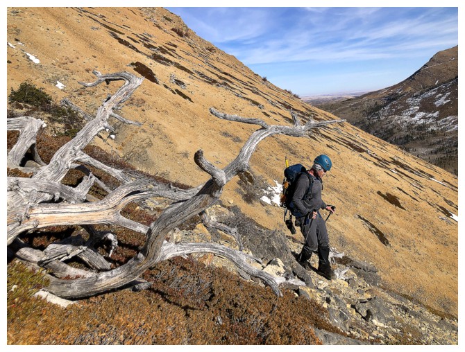
There's a dead tree you wouldn't want to meet in a dark alley! (photo by Dave)

Dave powers by the Beast!

A large group of deer on Drywood's southeast face (photo by Dave)

The Muffin and The Croissant are also always with us (photo by Dave)

Dave, again in front, leads an easy and very scenic section before the more challenging terrain

At 2640 m The King of The Castle is Loaf Mountain

Heading for a short scrambly section (photo by Dave)

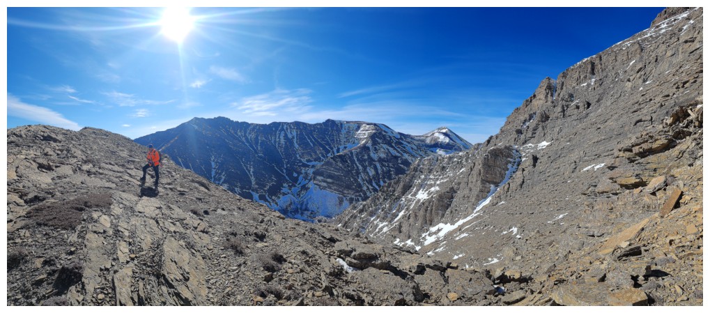
Upcoming difficulties along the ridge will soon force us to traverse into the drainage (photo by Dave)

But we are going to tackle the ridge until we encounter them (photo by Dave)

Dave traverses

Me following in Dave's bucket steps is a foreshadowing of things to come (photo by Dave)

Big terrain and big walls in front

Stunning rock at every turn

After spending a short amount of time near the drainage, Dave leads us back to the ridge

He disappeared shortly after

There is he, ascending a gap

Back on the ridge, awed by the steep east side
Working my way over to the ridge (photo by Dave)

What is Dave is checking out?

This
narrow couloir down the east side. It's much steeper than it appears,
as we both commented on feeling a little queasy looking down it! (photo
by Dave)
One of those points where Dave warned me against going east! (photo by Dave)

Same as above (photo by Dave)

And again (photo by Dave)

Another close-up of the amazing summit block of Drywood. Ascending the
snow gully in the centre looked very appealing, but not on this day with
high avalanche conditions. Also, as stated, everything on this mountain is much steeper
than it looks.

The route-finding continues

Dave steps across a gap, looking for a way up

He found this cool feature

Getting close to the crux rock band

Dave stays well clear of that death-trap of a cornice

What am I looking at? (photo by Dave)

Nothing - there is nothing but air down there!

Some of the vertical walls on the east face

Round 2 of "Don't Go East!!" (photo by Dave)

The bigger picture (photo by Dave)
Here comes the crux

Dave puts away his poles for this section of hands-on scrambling

The crux move is right at the top

Dave's view of me (photo by Dave)

He's up

My turn with the crux move (photo by Dave)

Above the crux, but there is still lots of terrain to cover

Foolishly I only brought 2 litres of water and so I had to consume my
emergency Red Bull. Too bad it didn't actually "give me wings", at
least for the remainder of the ascent! (photo by Dave)

Dave sends me up ahead for a photo op (photo by Dave)

Another look down the vertiginous east face (photo by Dave)

I'm still in the lead (photo by Dave)

That didn't last long!

The beautiful rock is a constant

Spot the Scot again. I need to get Dave a bright orange jacket so I can see him (or I just need to be faster!)

Round 3??

My lichen shot of the day

Dave is almost onto the final ascent slope

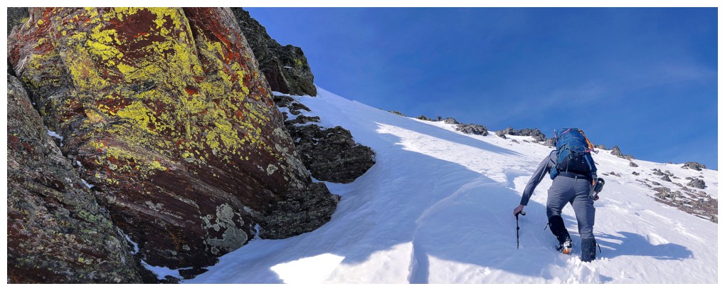
Time for crampons and an ice axe. Once again, this slope is much steeper than it looks (photo by Dave).

Up he goes

Dave graciously carves out steps in the snow for me to follow in

I'm catching up, but only because Dave is doing all the real work (photo by Dave)

Better representation of the steepness of the terrain

Almost there
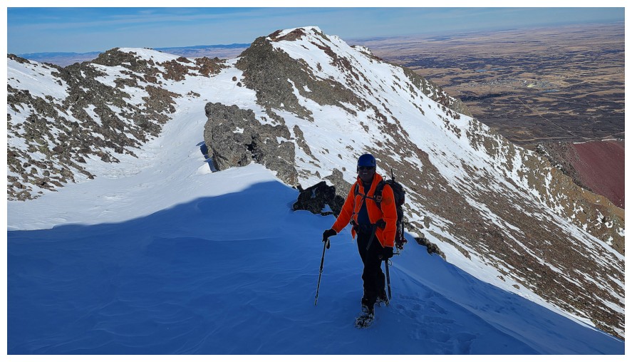
On the summit ridge (photo by Dave)

Checking out the view on the north side (photo by Dave)

This view

Dave a ready for the final ascent to the summit
Summit views

Ciabatta and The Breadsticks and Pastry Peak in the foreground (photo by Dave)

Loaf (photo by Dave)

Redwood Peak (foreground) and Drywood SW (photo by Dave)

Pincher Ridge and Victoria Peak (left of Pincher) (photo by Dave)

Windsor Mountain and Castle Peak (photo by Dave)

Victoria Ridge in the centre (photo by Dave)

Prairie Bluff - fresh off a very recent ascent up the stunning northeast face (photo by Dave)

Slow guy at the top (photo by Dave)

Fast guy at the top

Another terrific view of Loaf (photo by Dave)

Tons of familiar and worthwhile summits here: Spionkop, Dungarvan, Cloudy Ridge Junior, Cloudy Ridge, and Cloudowan Northeast (photo by Dave)

Descending the summit block (photo by Dave)

The start of the snow slope. We faced-in all the way down.

I follow (photo by Dave)

One of Dave's lichen shots (photo by Dave)

Dave was faster than me descending too (photo by Dave)

Eyeing up the crux (photo by Dave)

Sliding down it made the most sense (photo by Dave)

Followed by some easy downclimbing (photo by Dave)

I traversed over to check out the ascent route I used on the previous trip

Dave's view of me doing the checking out (photo by Dave)

We tried the snow but it was too inconsistent

Again, following in Dave's footsteps (photo by Dave)

Onto the scree (photo by Dave)

Super random tree

Looking back at the part of the ridge we scrambled up/around

One more shot at the snow

One more failure. Dave is up to his waist in it!

This descent route goes directly down to the gas road (photo by Dave)

Dave and the descent route
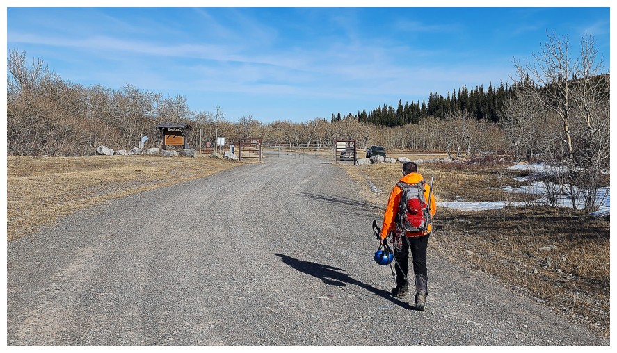
Seconds away from the end of an awesome day! (photo by Dave)
The End
LOG