Pincher Ridge VIII
April 5, 2025
Mountain height: 2423 m
Total elevation gain: 946 m
Ascent time: 4:40
Descent time: 2:20
Snowshoeing
with Dave.
Winter is back!
After enjoying
three terrific Southern Alberta ascents (Table, Drywood, Prairie Sky) in March that were, more or less,
snow-free (Thrift was also terrific but the snow added considerable challenge),
it was good the see the southern mountains plastered in the white stuff again. 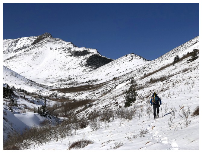 After all,
historically March is the snowiest month of the year in this neck of the woods.
After all,
historically March is the snowiest month of the year in this neck of the woods.
Of course, all
this new snow also added considerable challenge to picking an objective for the
day. We eventually decided to snowshoe up the valley on the north side of
Pincher Ridge. There, if conditions permitted, we could attempt one of: Pincher
Ridge (true summit), Pincher Ridge (Centre), The Horn, or Bridle Peak and Cinch
Hill.
We put
snowshoes on right away and they would stay on our feet almost all the way to the
summit. At first, travel was reasonably fast, the snow depth not significant
and the snowshoes doing their job. And once out of the trees, the scenery was
fantastic. Although this was my third visit to the infrequently traveled
valley, I didn’t fully appreciate how picturesque it is until this day.
Further up the
valley, our luck ran out with ease of travel, courtesy of much deeper,
unsupportive snow and a significant headwind. We were trading the
trail-breaking duties, but eventually those had to take an ice hockey “short
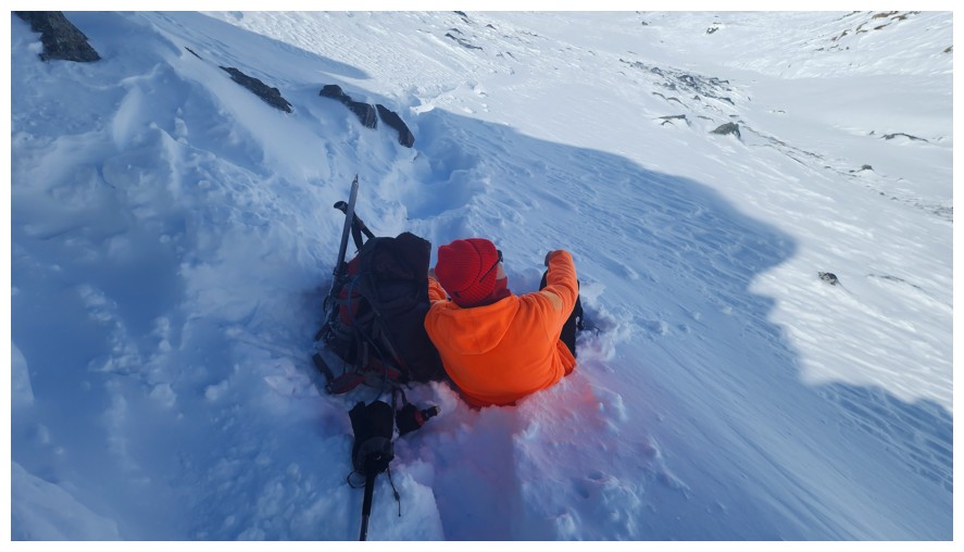
shifts” approach. 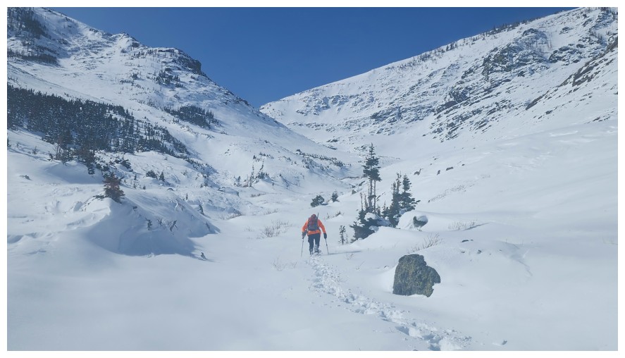 Wisely, Dave suggested we take a food break underneath a
wind-sheltered, yellow lichen-covered group of rocks.
Wisely, Dave suggested we take a food break underneath a
wind-sheltered, yellow lichen-covered group of rocks.
With renewed
energy, we continued up the valley, following the same path Doug, Scott, Dave
and I had used on descent, after reaching the summit of The Horn in January of 2024.
Of course, the snow added considerable challenge (yet again!) to this section.
However, we were so much enjoying the winter scenery, it was impossible not to
push on.
Decision time
at the 3-way intersection where Pincher Centre, Pincher North, and The Horn
meet. Pincher Centre would have been the preference for us both. Of all the
four Pinchers, Centre is my personal favourite, boasting outrageously colourful
views, especially during larch season. Unfortunately, the ridge leading to the
summit of Centre looked like a death trap with all the new snow. The Horn was
close by and would have been the easiest, but (yet again!) saying no to the
highest summit of the three was impossible. 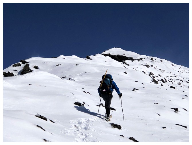 We set our sights on the true
summit of Pincher Ridge.
We set our sights on the true
summit of Pincher Ridge.
Turning east,
we soon gained the peak’s west ridge and started up. Two things were now in our
(my) favour: a tailwind and Dave’s renewed energy level. He graciously broke
trail all the way to the summit. We ditched our snowshoes a few hundred metres
from the top, due to the precarious boulder strewn terrain. Needless to say, the summit
view was spectacular.
Almost needless
to say, the entire descent was mercifully easy, taking exactly half the time of
the ascent. The wind had filled in our snowshoe tracks in places, but we were
still able to find them; the tailwind for most of the return trip was a
godsend, and the warm temperatures had melted enough snow for us to complete
the last kilometre or so without snowshoes.
An incredible
day of breath-taking scenery and breath-stealing travel. Huge thank you to Dave
for his fine company sharing both the suffering and the triumphs with me!
Click HERE to see Dave's awesome report!
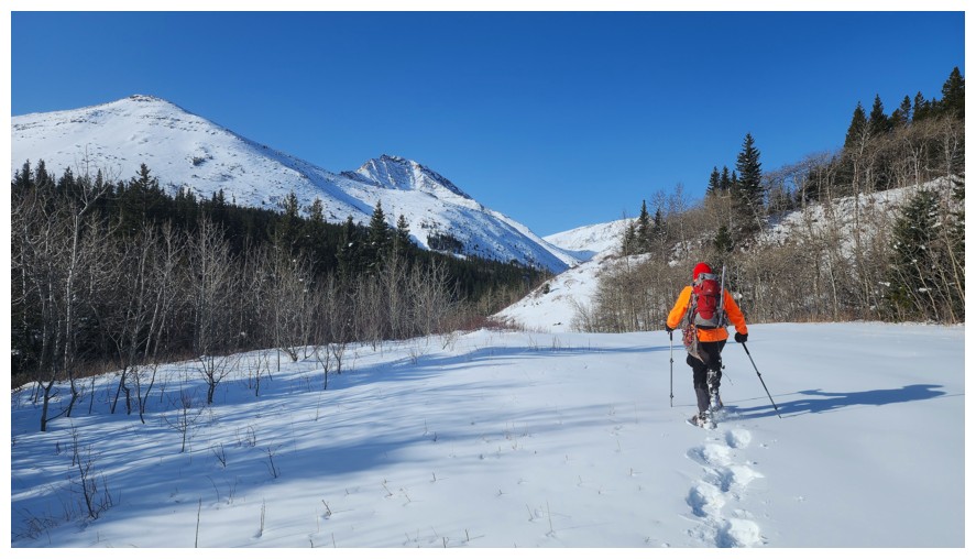
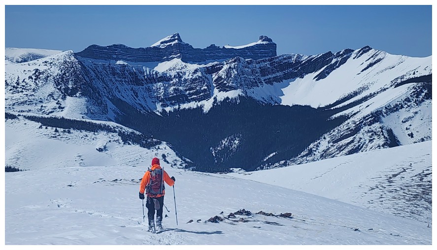
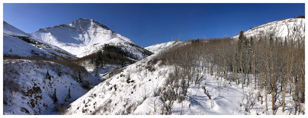
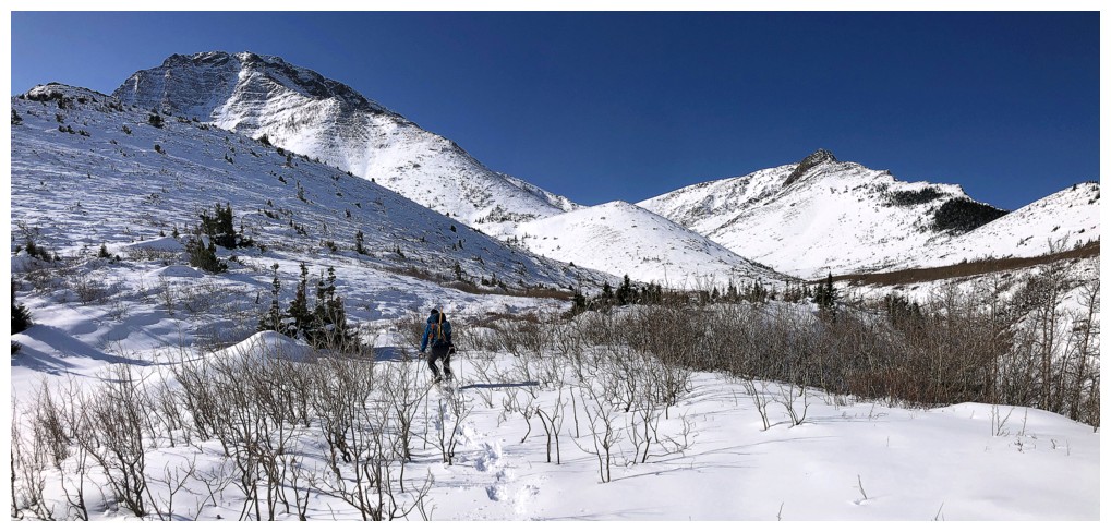
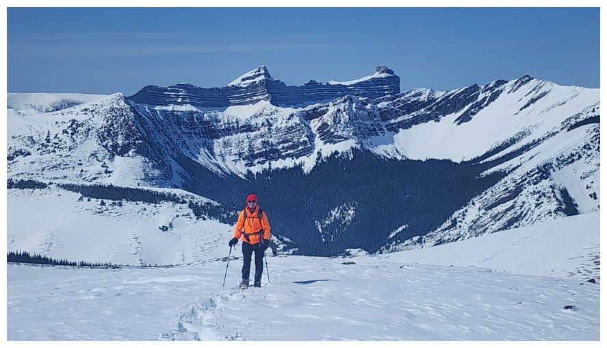
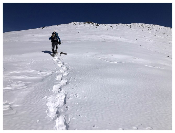
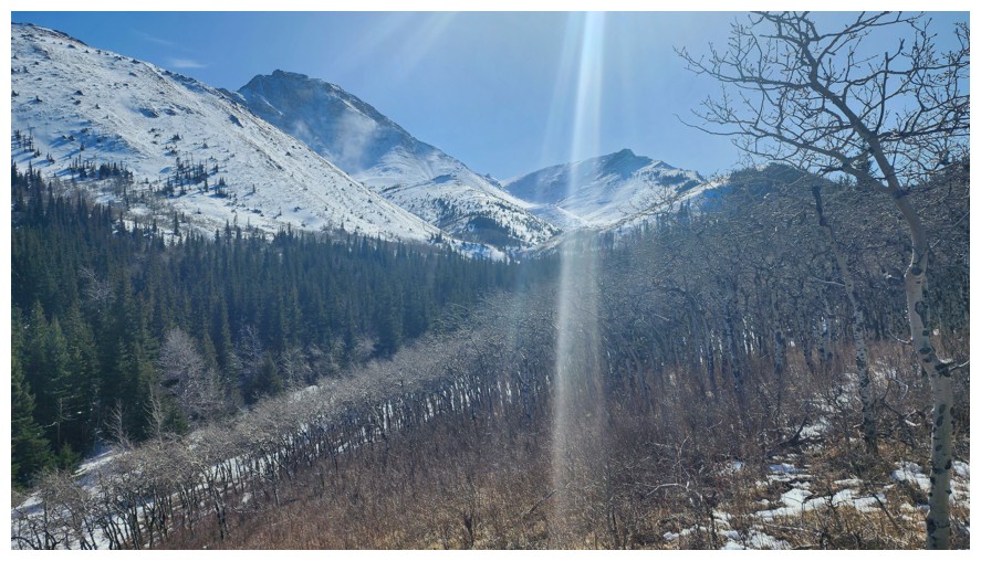
Off
we go. Pincher Ridge is just left of centre, but the route we will take
goes all the way to the west side of the peak first (photo by
Dave).
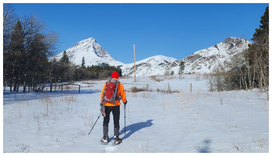
Within minutes we get views of Victoria Peak, Prairie Storm, and Prairie Sky (photo by Dave)
Sky, Fire, and the true summit of Prairie Bluff
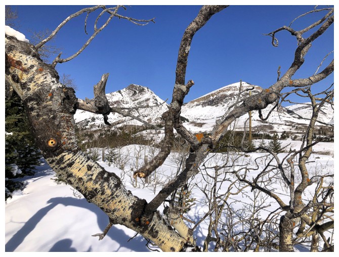
Sky and Fire, through a mess of tree branches
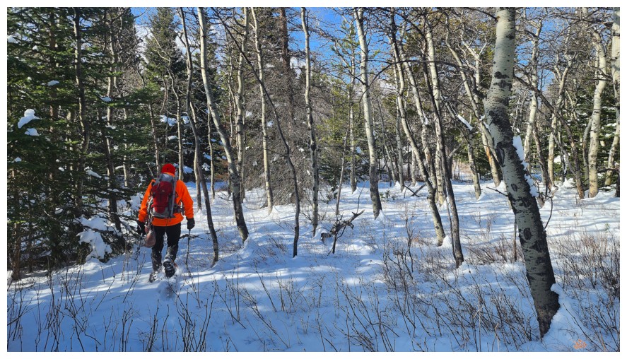
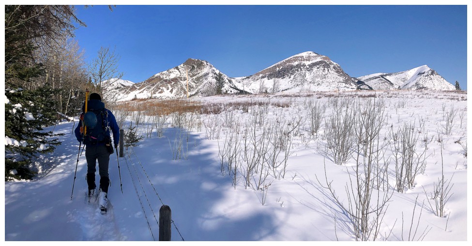
Light forest to get to the trail (photo by Dave)
Out in the open for a little while. Cinch Hill at the left (photo by Dave).
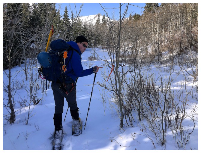
Dave is a little too excited to see some flagging in the trees!
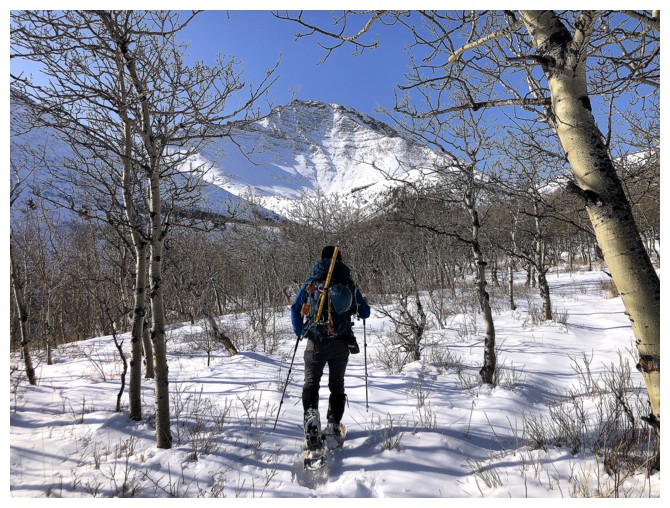
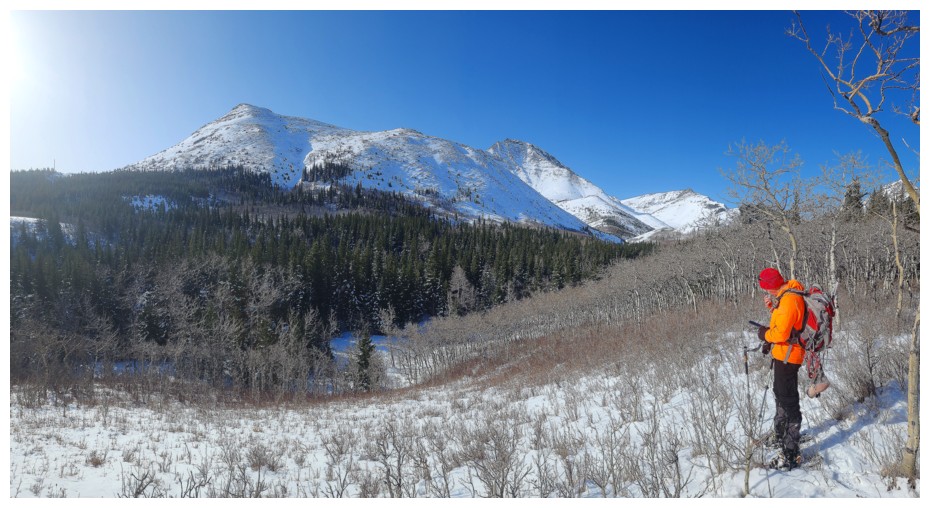
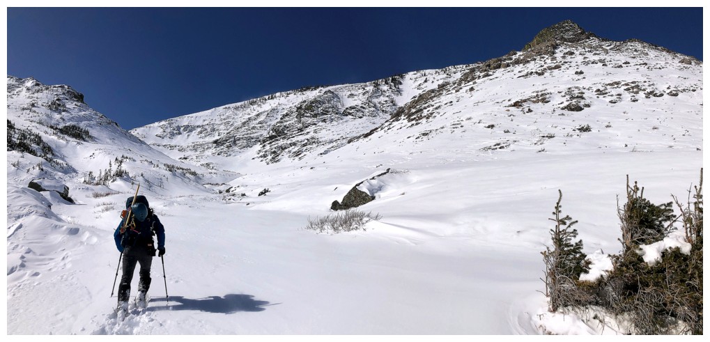
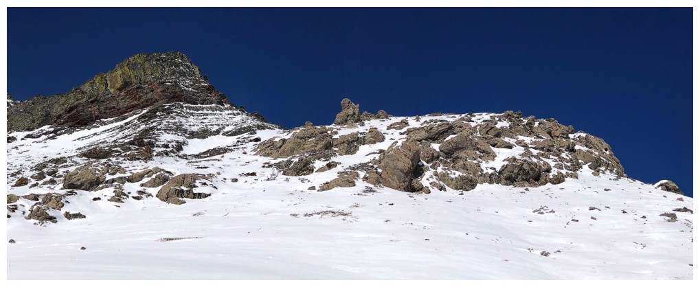
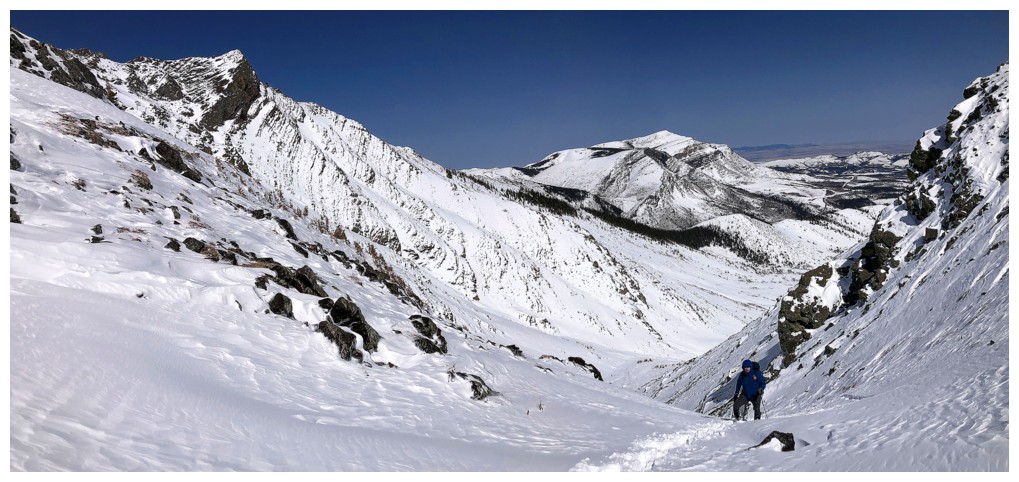
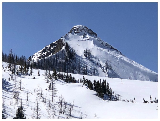
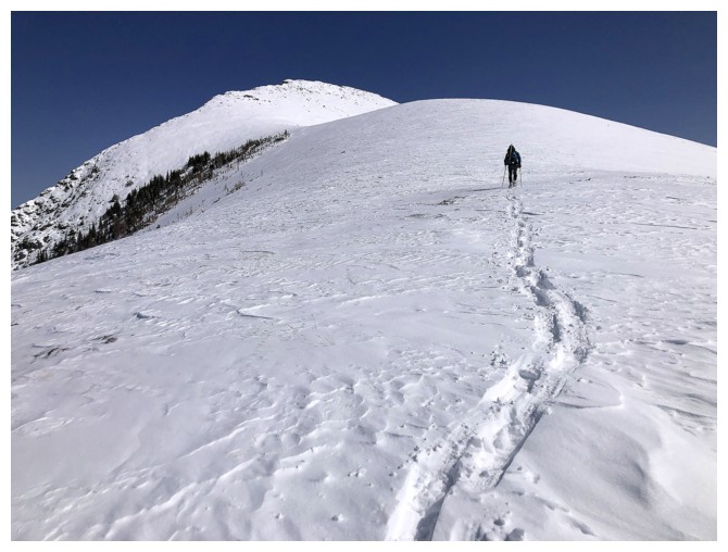
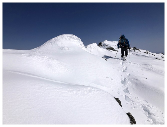
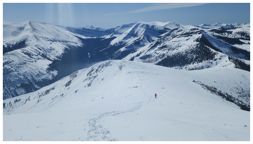
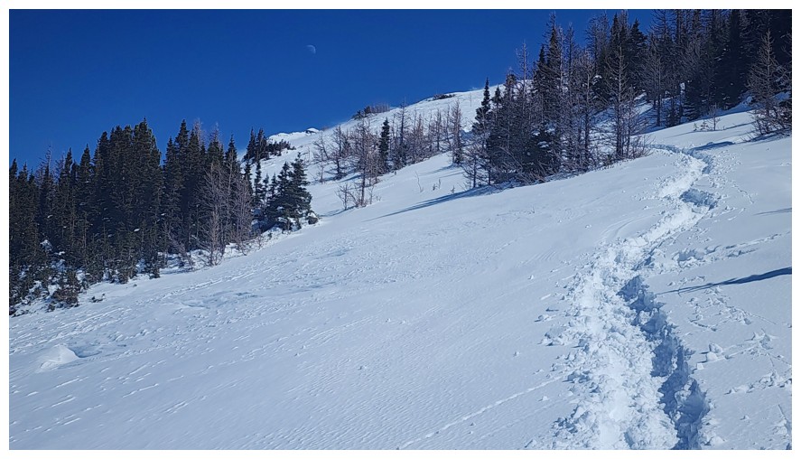
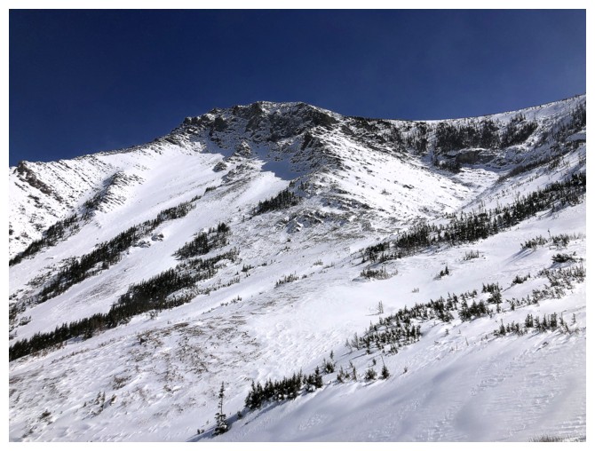
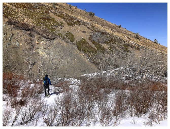
Pincher Ridge directly ahead
Out in the open for good
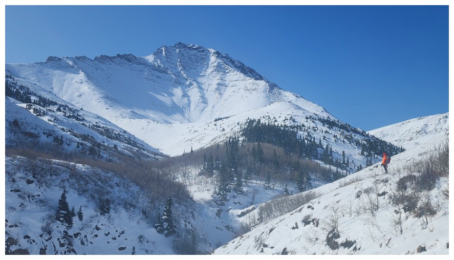
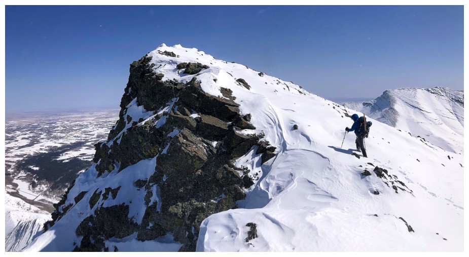
Stunning view of Pincher's northeast face. Mark and I had an epic there in 2006 (photo by Dave).
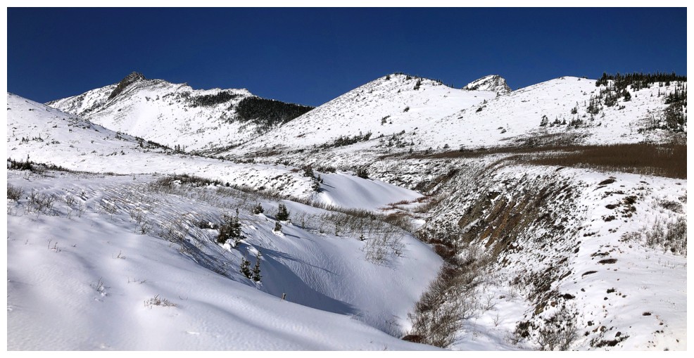
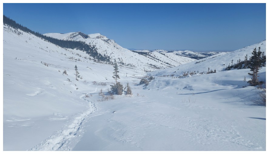
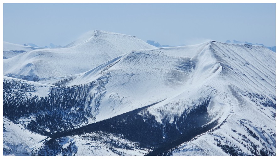
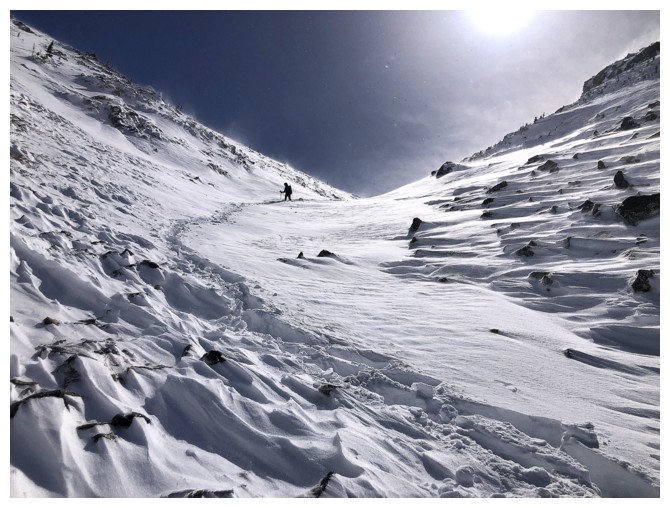
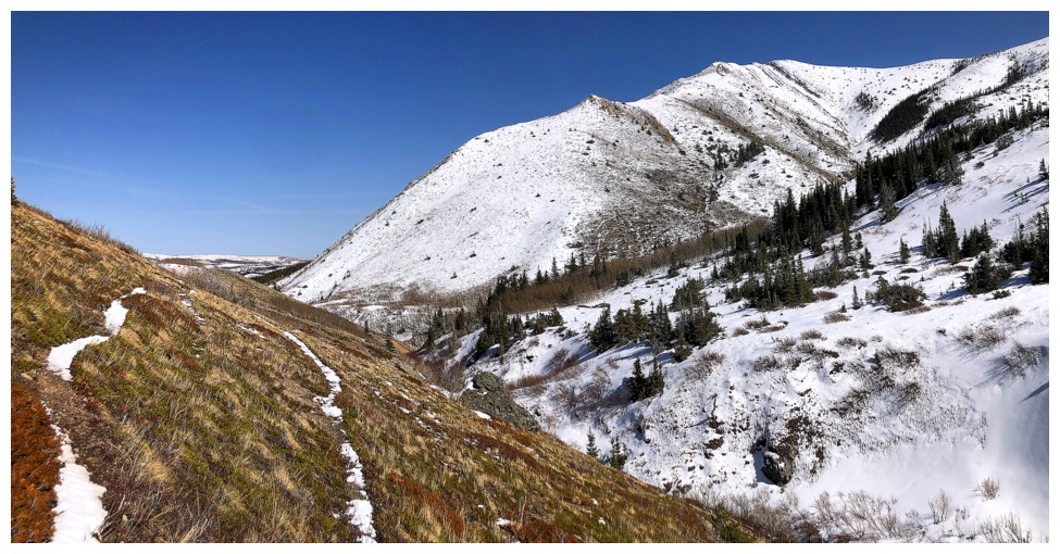
The whole valley is stunning
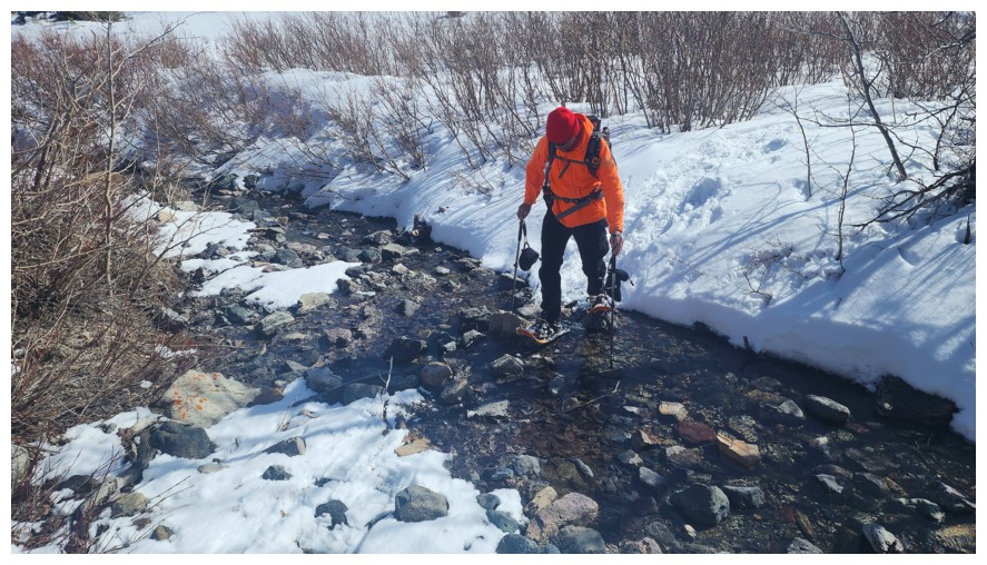
Descending to the creek that divides the valley (photo by Dave)
Continuing travel on the other side
One route up The Horn follows the ridge here from right to left
Crossing another subsidiary creek below Pincher (photo by Dave)
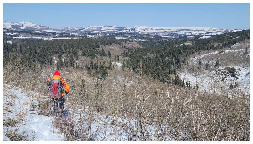
And onward
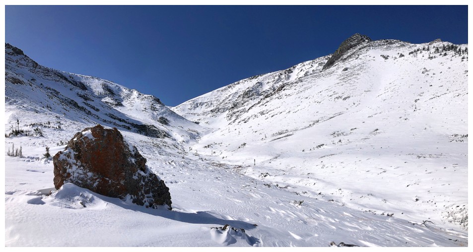
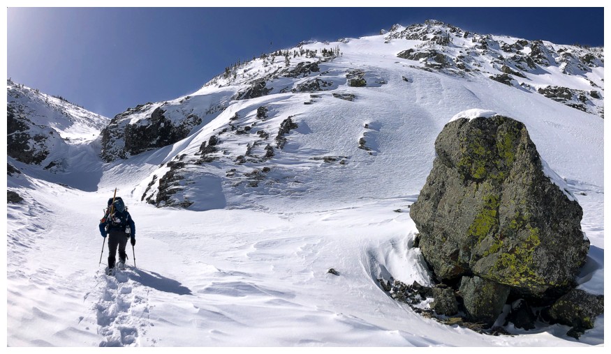
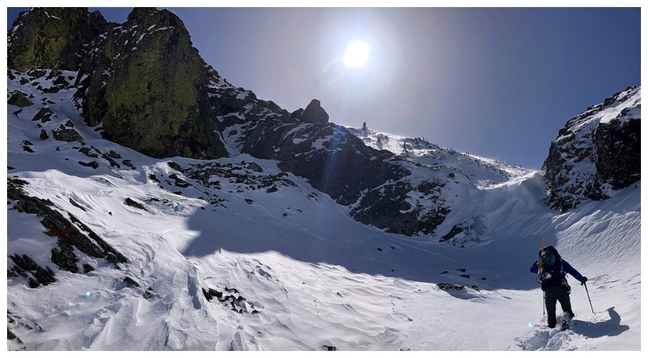
Big Rock encounter that doesn't involve beer
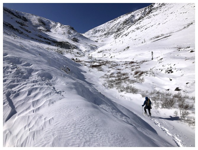
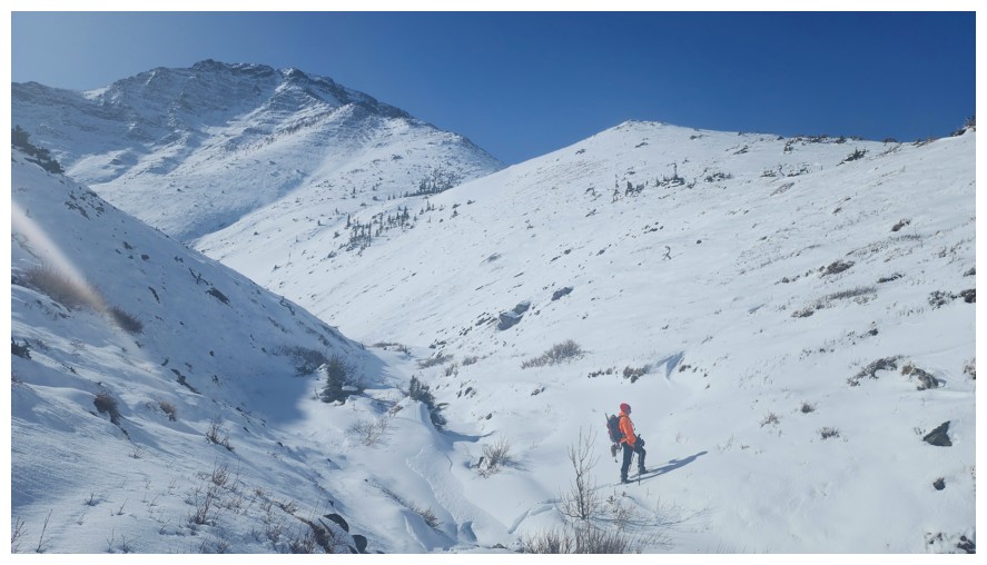
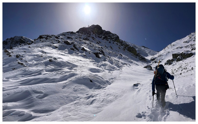
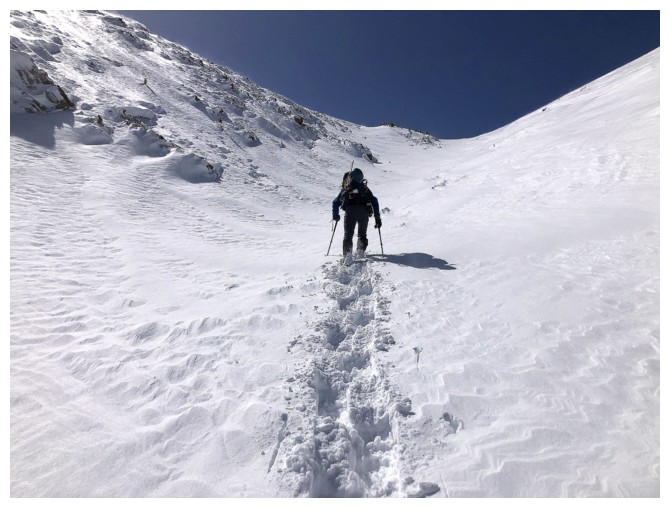
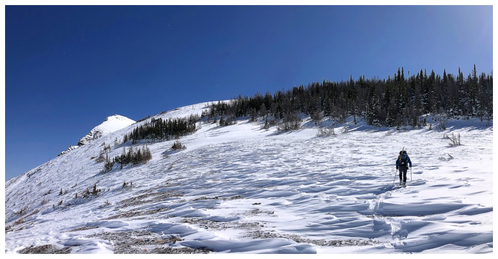
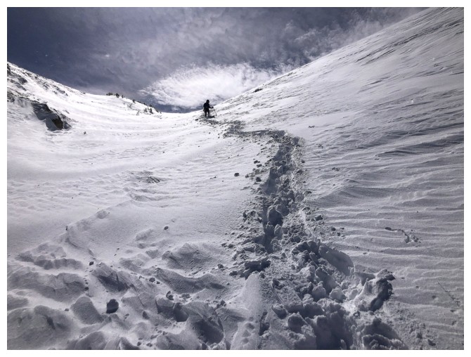
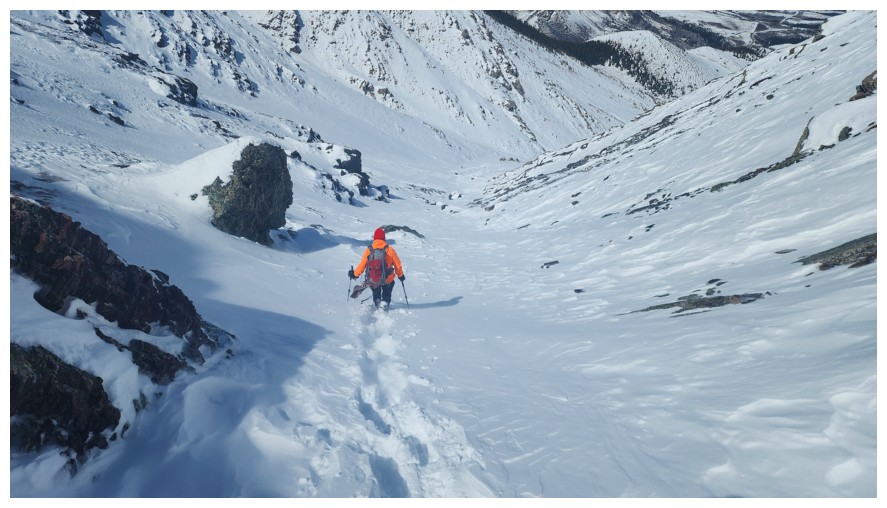
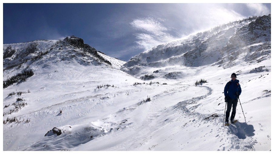
We were still making good progress at this point, but that would soon change
Looking back to where we came from (photo by Dave)
We are now in "short shifts" mode for trail-breaking
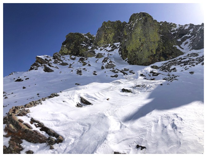
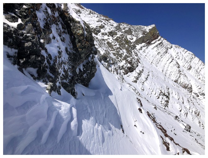
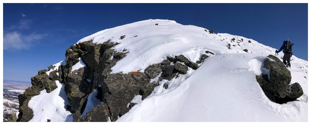
The exposed rock on the east face of The Horn is exquisite
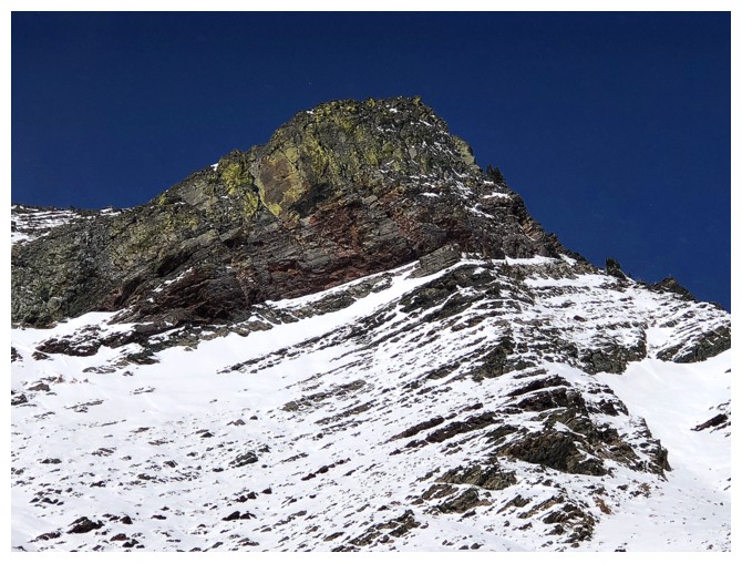
Close-up
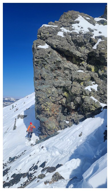
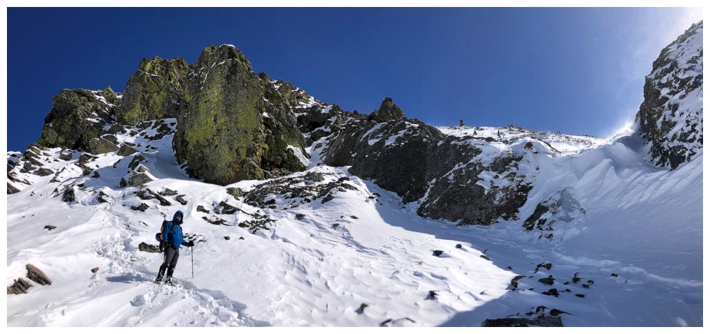
Dave leads the way to the rock band at the right where we will take a much-needed break
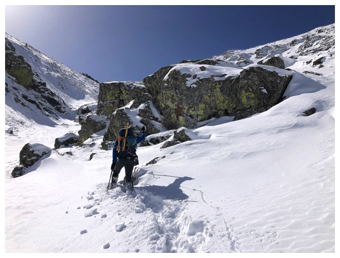
Almost there
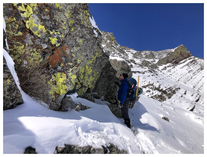
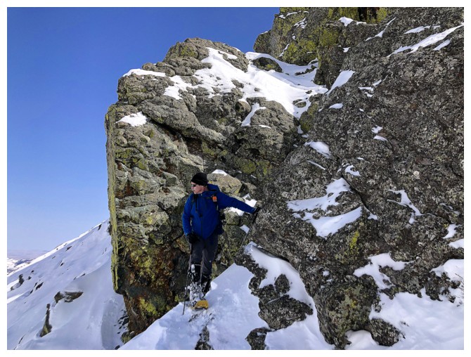
Dave checks out the cool lichen-covered rock
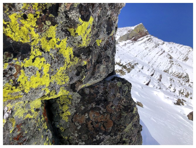
Close-up with The Horn in the background
Another Big Rock and still no beer
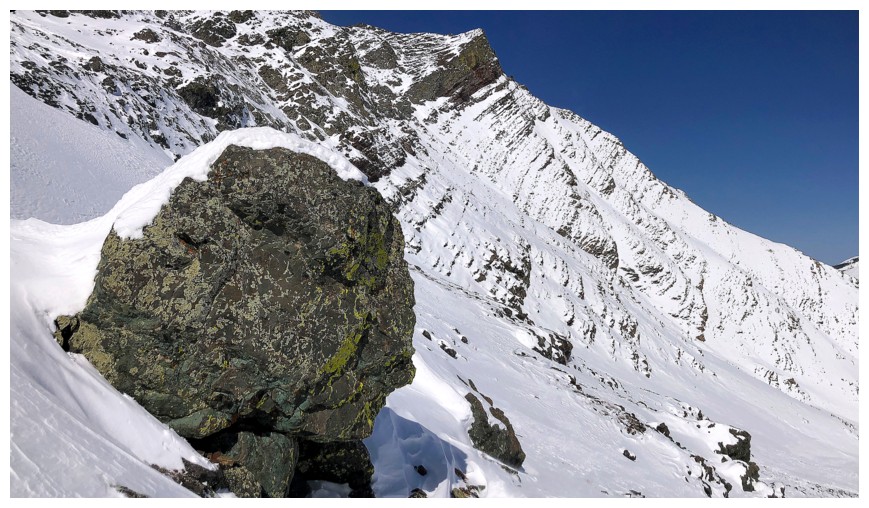
Same as above
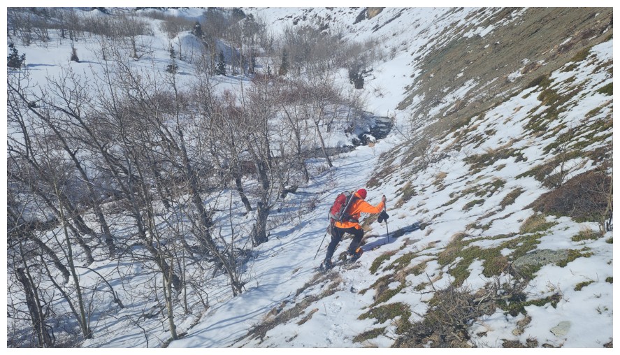
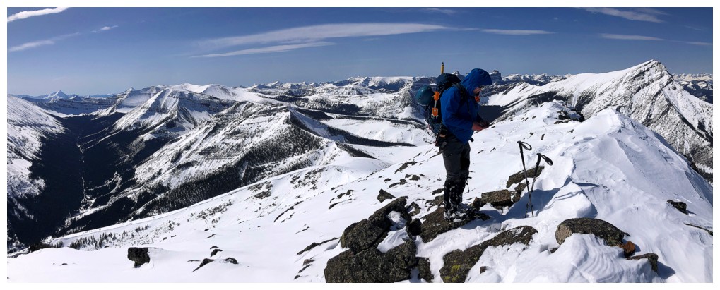
Approaching the crux of the trip. Dave sees Mr. Spock face's in the
snow on the rock just right of the big pinnacle at the left; I see a
duck with perfectly straight teeth.
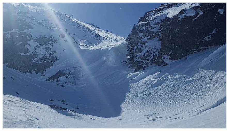
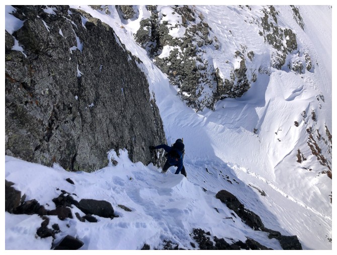
A small, but vertical frozen waterfall ahead (photo by Dave)

Dave sizes it up
Too bad the Sun doesn't reach this beautiful lichen-covered rock
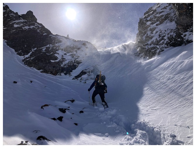
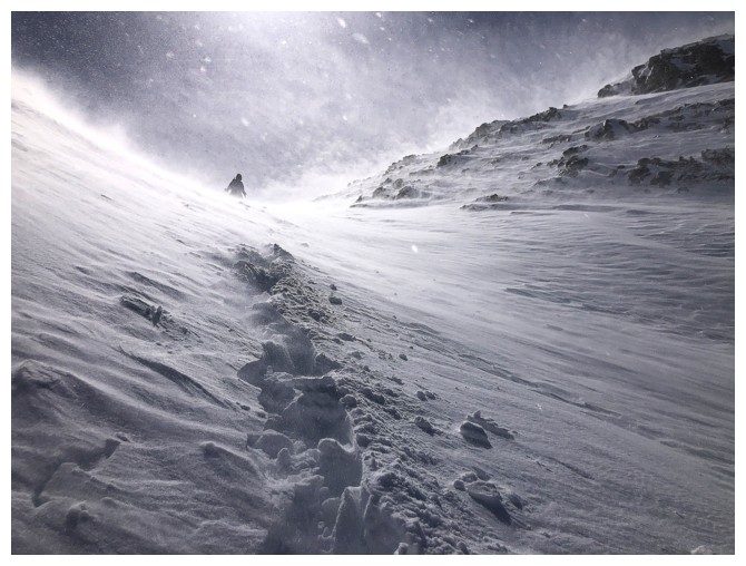
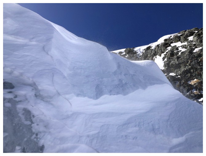
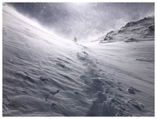
Lots of snow blowing over the frozen waterfall
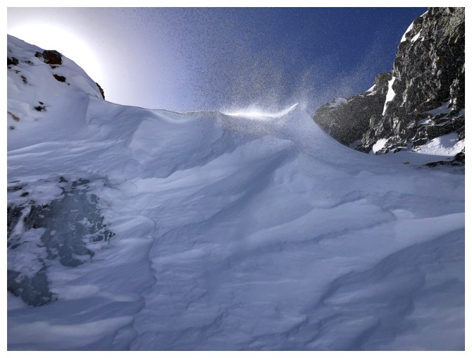
The blowing snow created some cool scenes
We considered trying to squirm up the right side of the fall (left in the photo), but it was steep and icy
A little ice, snow, rock, and blue sky
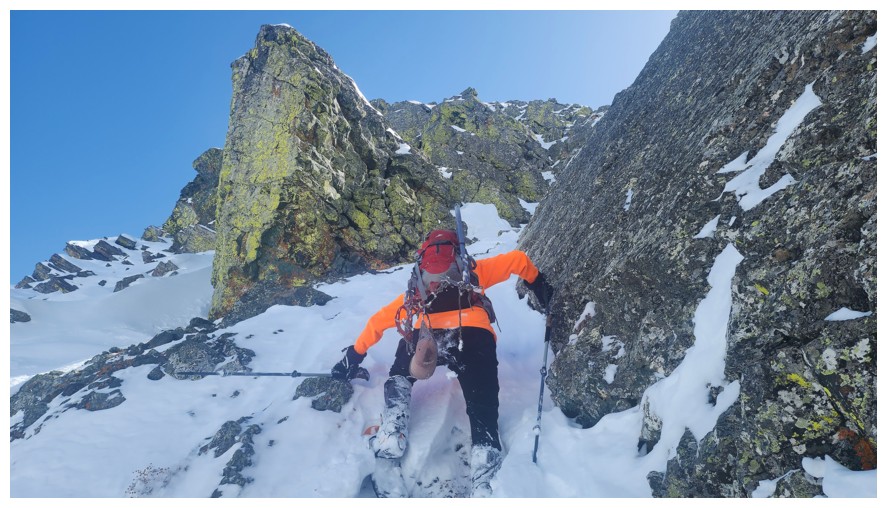
Took this route instead, which involves a few steep moves (photo by Dave)
Dave's turn
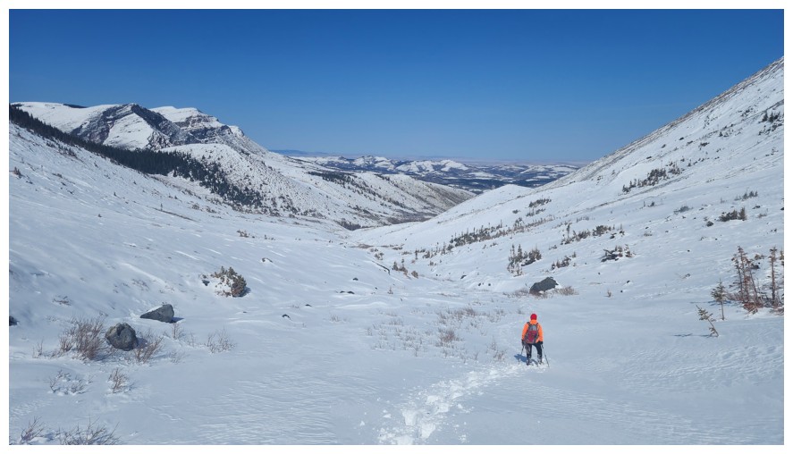
Short traverse back into the drainage
Resuming travel up the drainage (photo by Dave)
Same as above (photo by Dave)
Back to calm conditions (and just kidding about the duck)
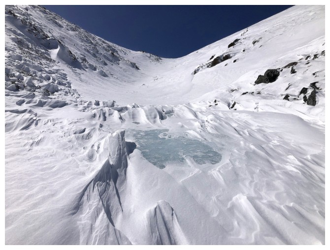
There's ice under all that snow

Dave passes by the ice
And then takes the lead
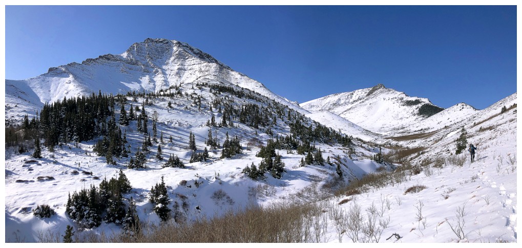
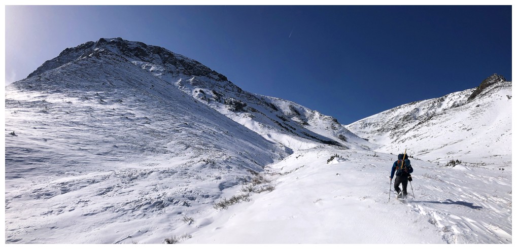
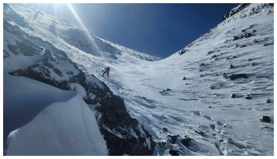
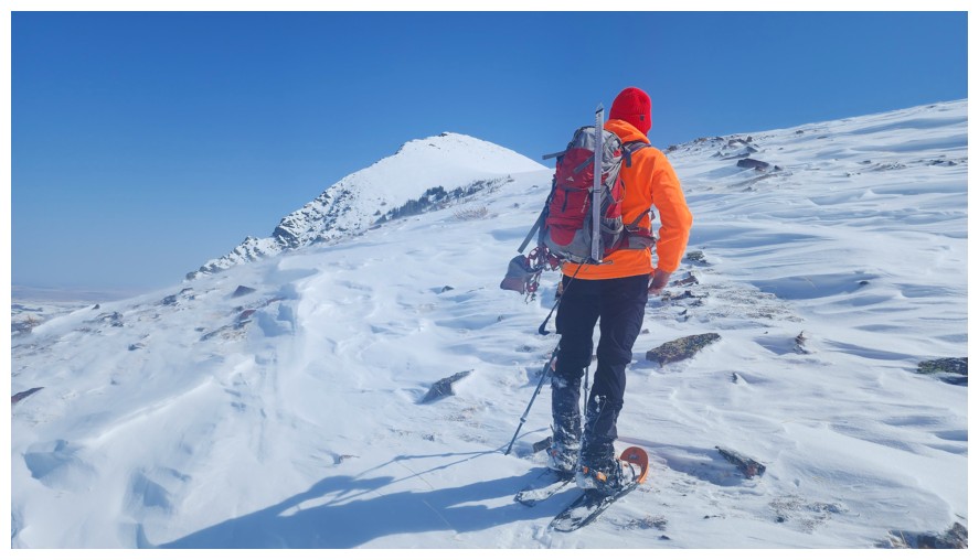
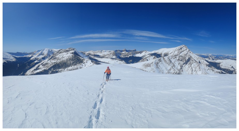
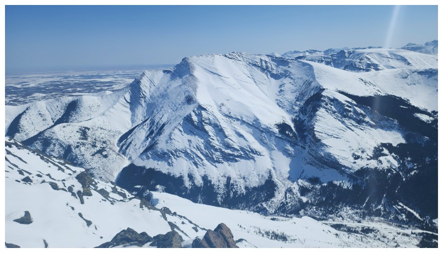
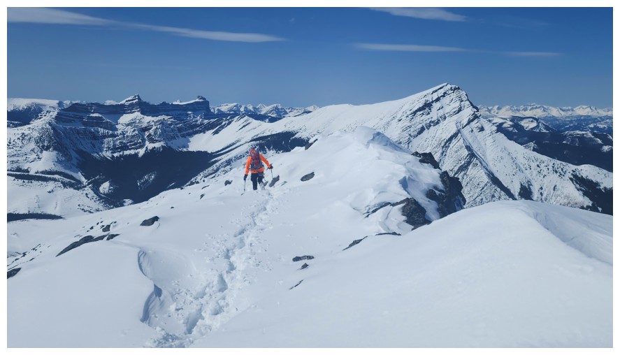
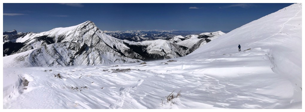
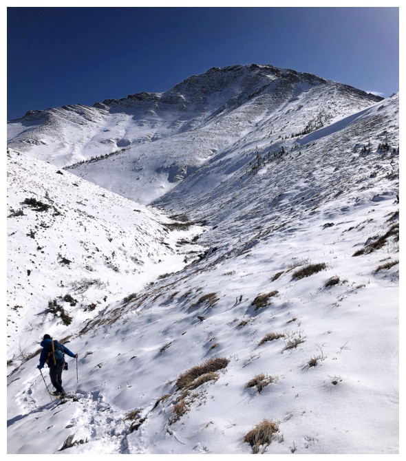
Pincher Centre appears (photo by Dave)
Close-up. That's a lot of new snow and a lot of uncertainty.
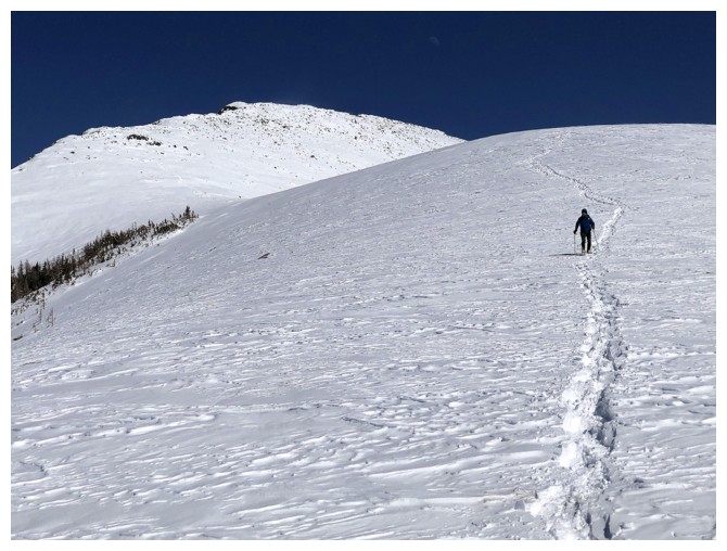
The true summit of Pincher (far left) looks far less intimidating

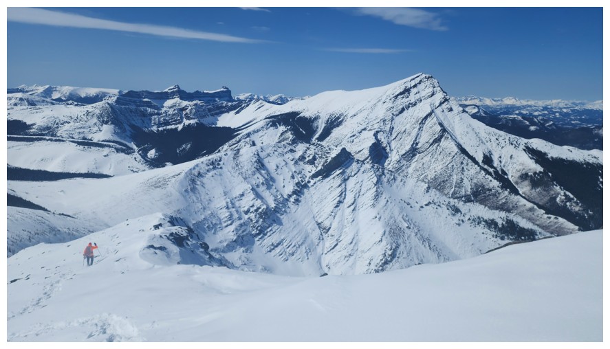
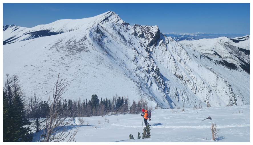
Big terrain. The Horn in the background (photo by Dave).
Mercifully there were a few sections that were more wind-blown (photo by Dave)
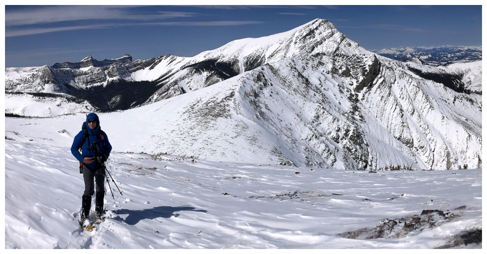
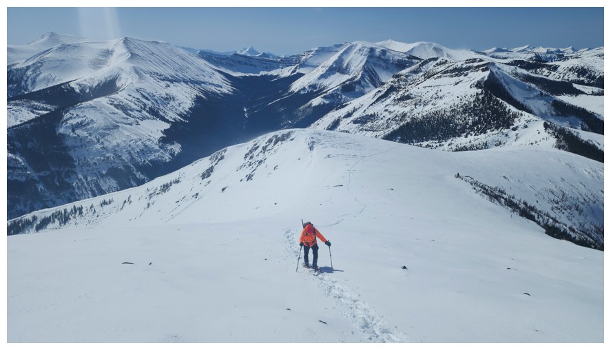
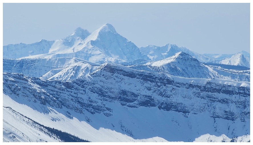
Victoria Peak asserts its dominance as the highest mountain in the immediate area. The traverse from Victoria Peak to Victoria Ridge remains one of the best ridgewalks in the Rockies.

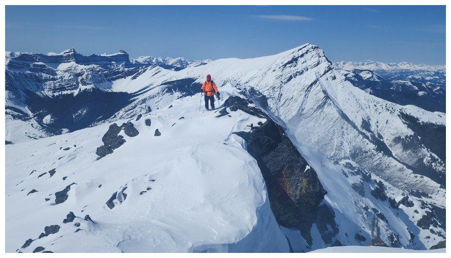
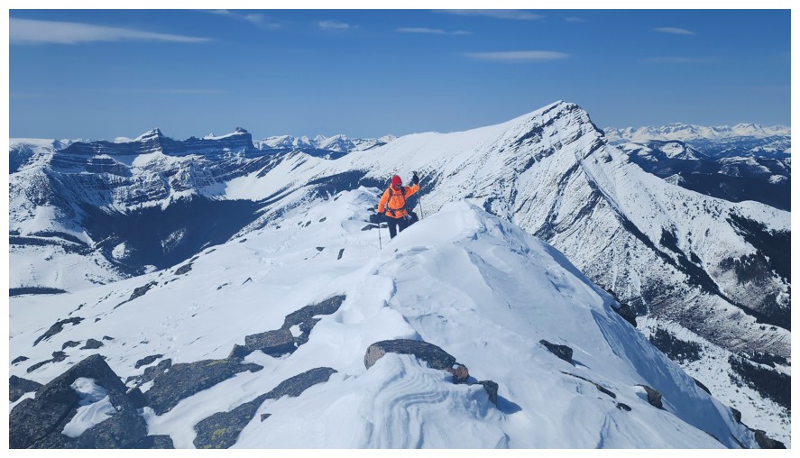
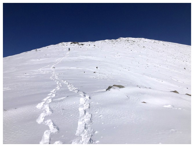
The southwest summit of Pincher Ridge (photo by Dave)
Windsor Mountain and Castle Peak are a picturesque pair (photo by Dave)
The simpler west slopes of Pincher are elegant in their own way
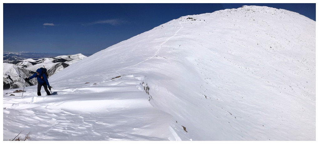
Following...(photo by Dave)
...leading (for now) (photo by Dave)
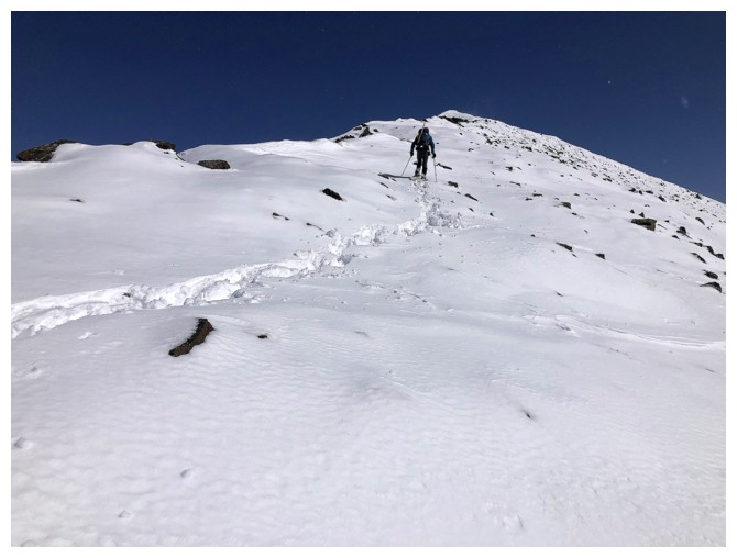
Dave led from here all the way to the summit
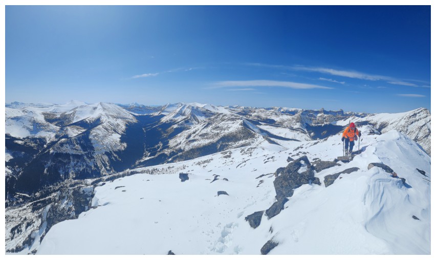
The view to the west gets better and better (photo by Dave)
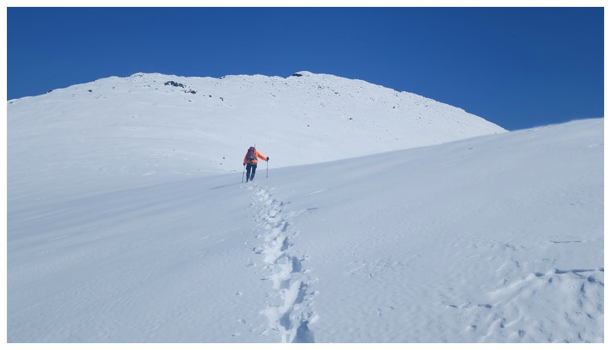
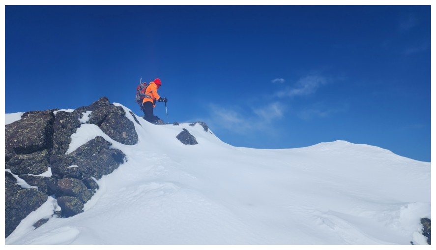
The terrain is getting rockier and the snow hides many dangerous holes
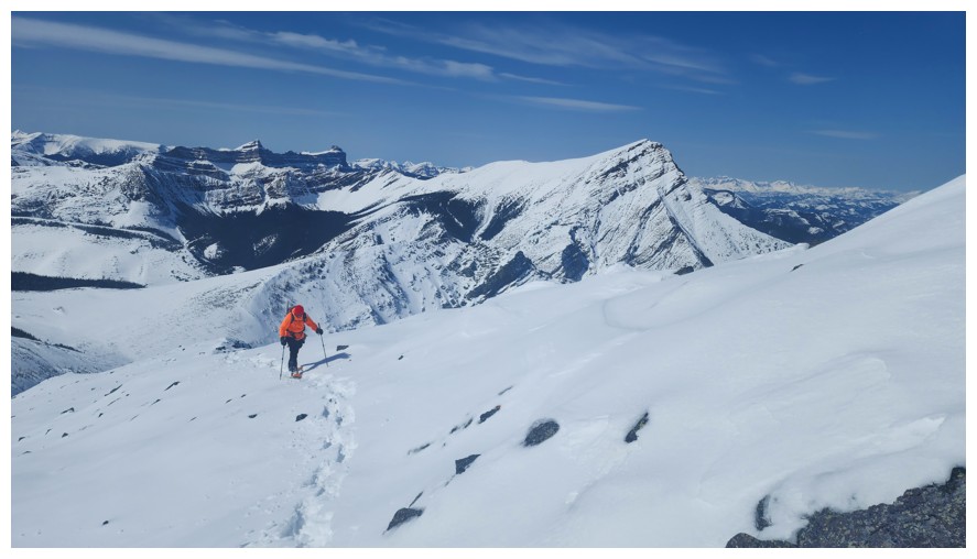
Last few metres with snowshoes (photo by Dave)
Dave proceeds without snowshoes
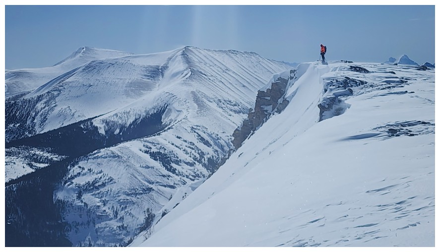
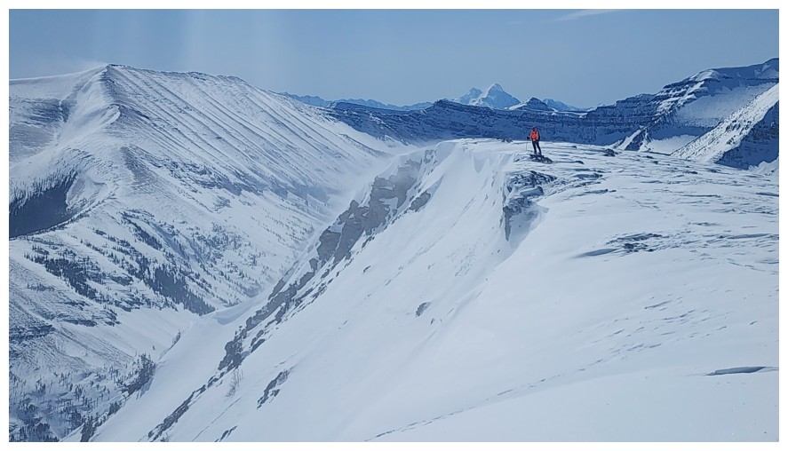
Minor detour to see the drop on the north side (photo by Dave)
There it is
Dave's view of me (photo by Dave)
Definitely steering clear of that cornice at the left
Another little highpoint to pose upon (photo by Dave)
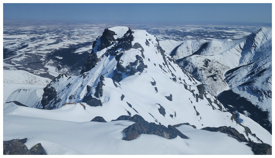
Final few metres (photo by Dave)
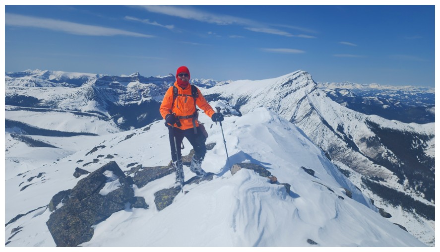
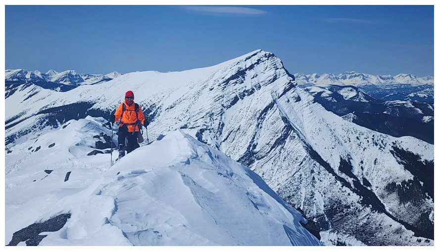
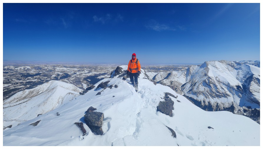
Summit! (photo by Dave)
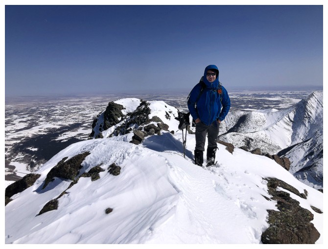
Dave!!
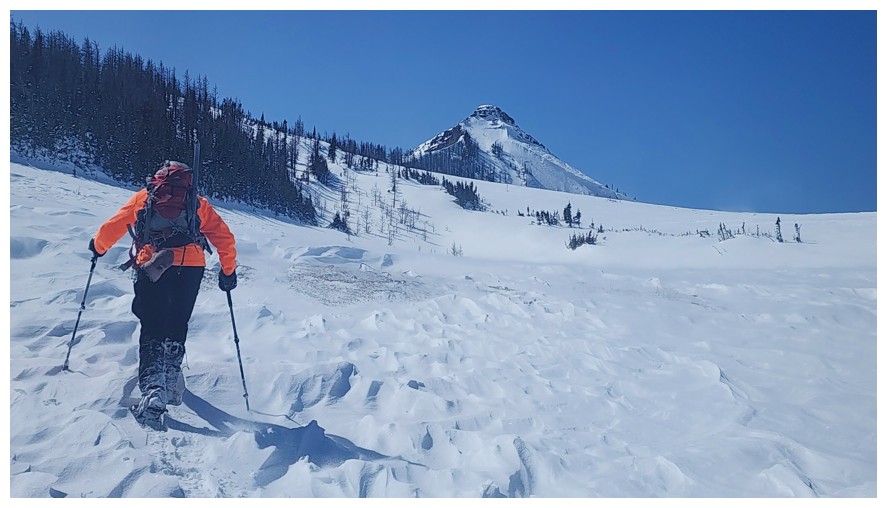
The north side of Drywood Mountain has at least one route to the summit (photo by Dave)
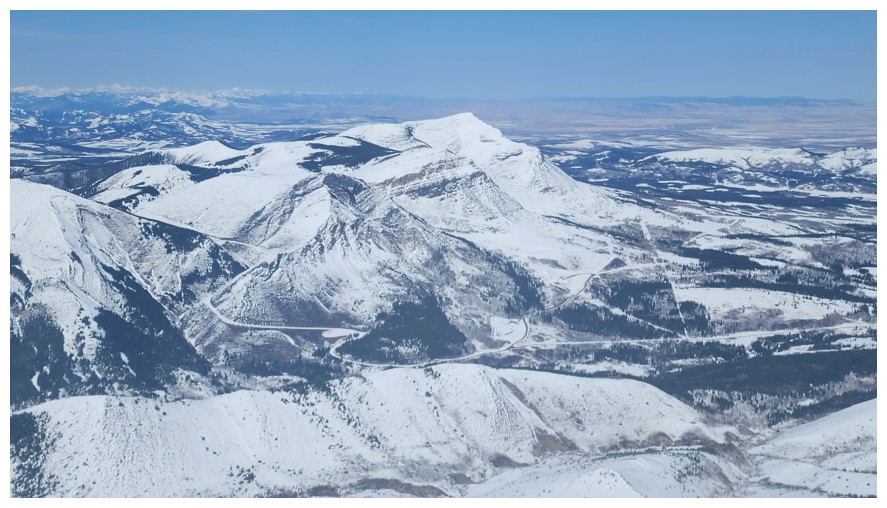
Most of the Prairie's of Prairie Bluff (photo by Dave)
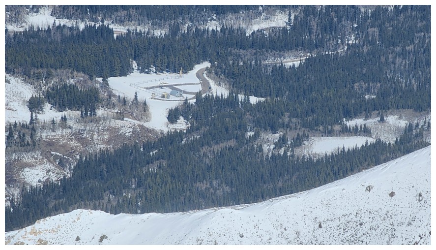
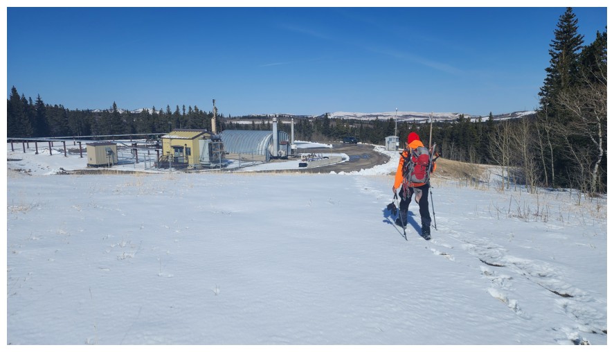
Super zoomed-in shot of the gas well where Dave parked (photo by Dave)
Loaf Mountain (left) and the Southwest summit of Drywood (photo by Dave)
The summit of Victoria Ridge in the centre (photo by Dave)
King Edward and Starvation peaks (photo by Dave)
View to the east. Getting over to the end of the ridge is possible, but not recommended when snowy (photo by Dave).
Trading places for the final summit shots
Same as above (photo by Dave)
Time to leave (photo by Dave)
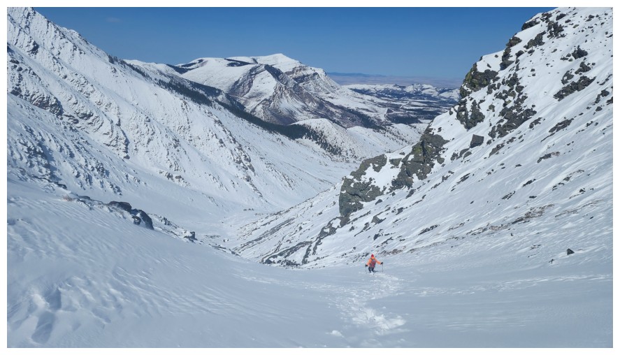
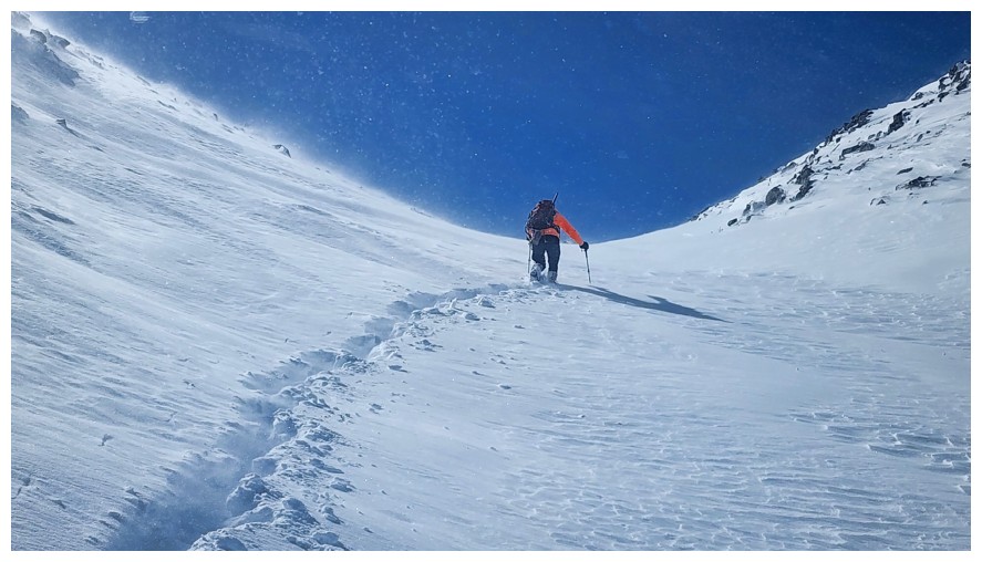
Had a strong headwind for the first section, but at least we are going downhill (photo by Dave)
Hard to keep the cameras at bay! (photo by Dave)
Making a new set of descent tracks was easier than stepping in the old ones for some sections
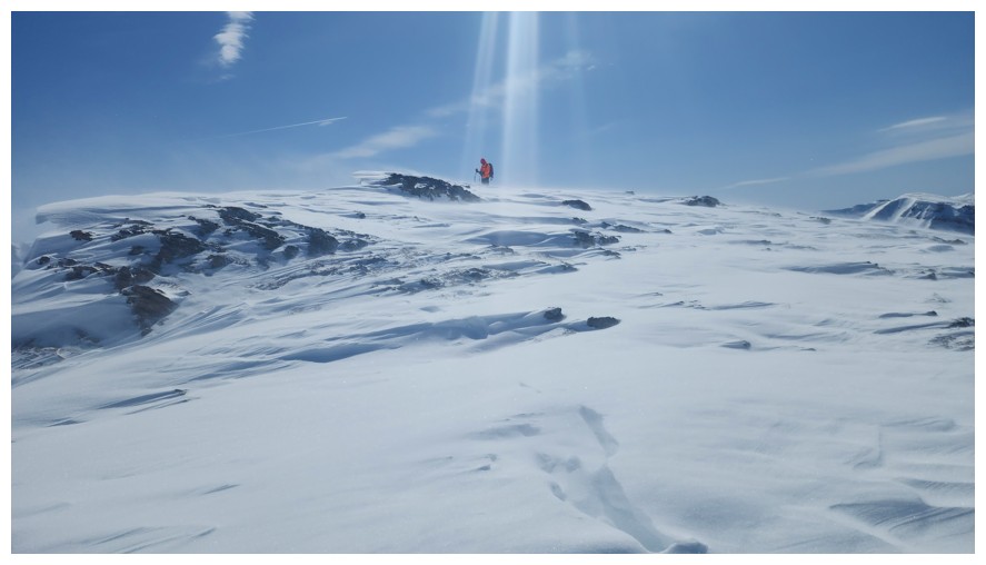
Quickly ran up to a little highpoint to check out the view, blowing snow, and cornice
Steps away from the highpoint (photo by Dave)
There. A small avalanche released on the slope below as I was standing there (photo by Dave).
There is no substitute for snowy scenes with a blue sky
Same as above with more
And again
Good framing on that one Dave! (photo by Dave)
Continuing down (photo by Dave)
Dave too
We would have loved to run up The Horn again, but neither had the required energy (photo by Dave)
The faint Moon makes an appearance (photo by Dave)
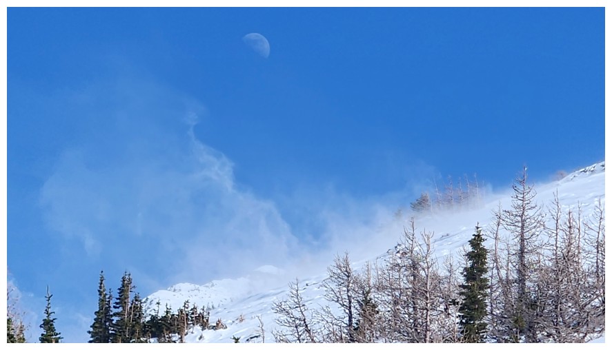
Super cool shot, as Dave's captures the Moon and the blowing snow (photo by Dave)
The wind has cleared this section while we were at the summit
Relatively calm
Not calm at all
Totally calm
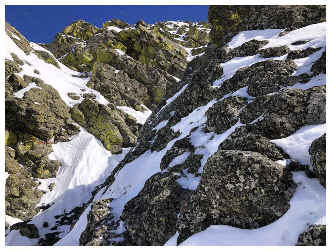
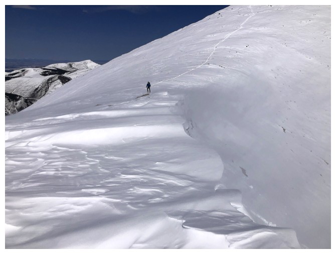
Back at the crux and the cool rock around it
We were able to avoid the steepest section, finding an easier route (photo by Dave)
Back onto more gentle terrain (photo by Dave)
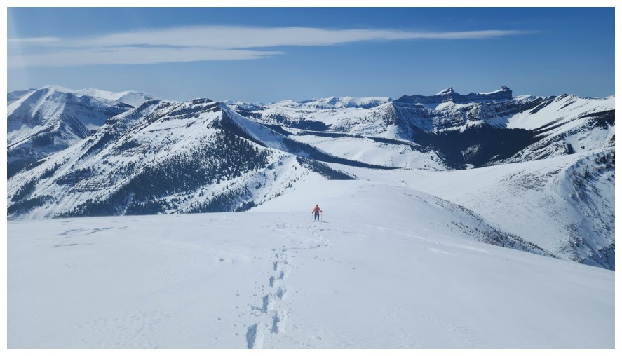
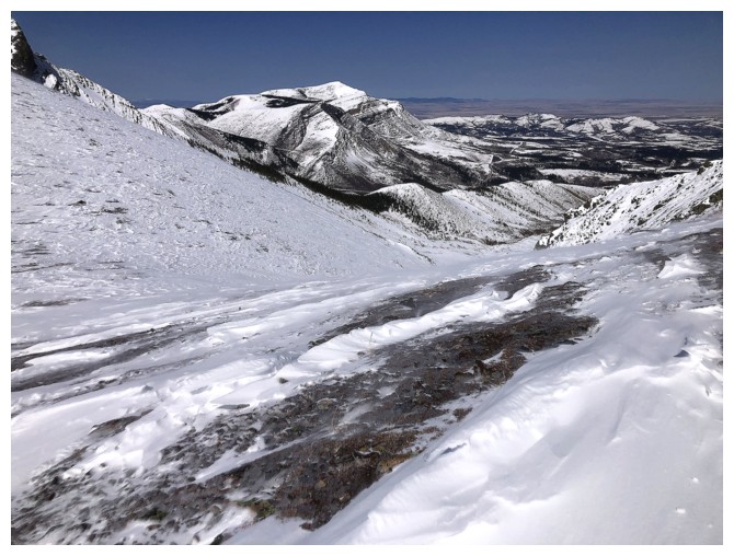
Overview of the whole area

Back to the rocks where we took a break on ascent
And we both agreed another break was in order (photo by Dave)
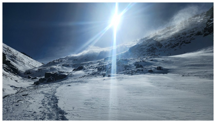
The blowing snow was very cool at times (photo by Dave)
Looks like there could be some interesting routes to the summit up this way, but definitely for Summer
The snow crawling down the mountain at the right was a highlight of the descent
Now onto much easier terrain, but our previous tracks are not clearly visible (photo by Dave)

Beer
Dave descends to that subsidiary creek
Approaching the main creek. Tons of snow has melted during the day.
Snowshoe creek crossing, minus the snow (photo by Dave)
Cinch Hill at the right, and shockingly bare slopes at the left
Still some distance to go, but the end is almost in sight (photo by Dave)
Parting look at Pincher Ridge and The Horn (photo by Dave)
Steps away from the end of an insanely cool day! (photo by Dave)
The End
LOG